Room in the open.
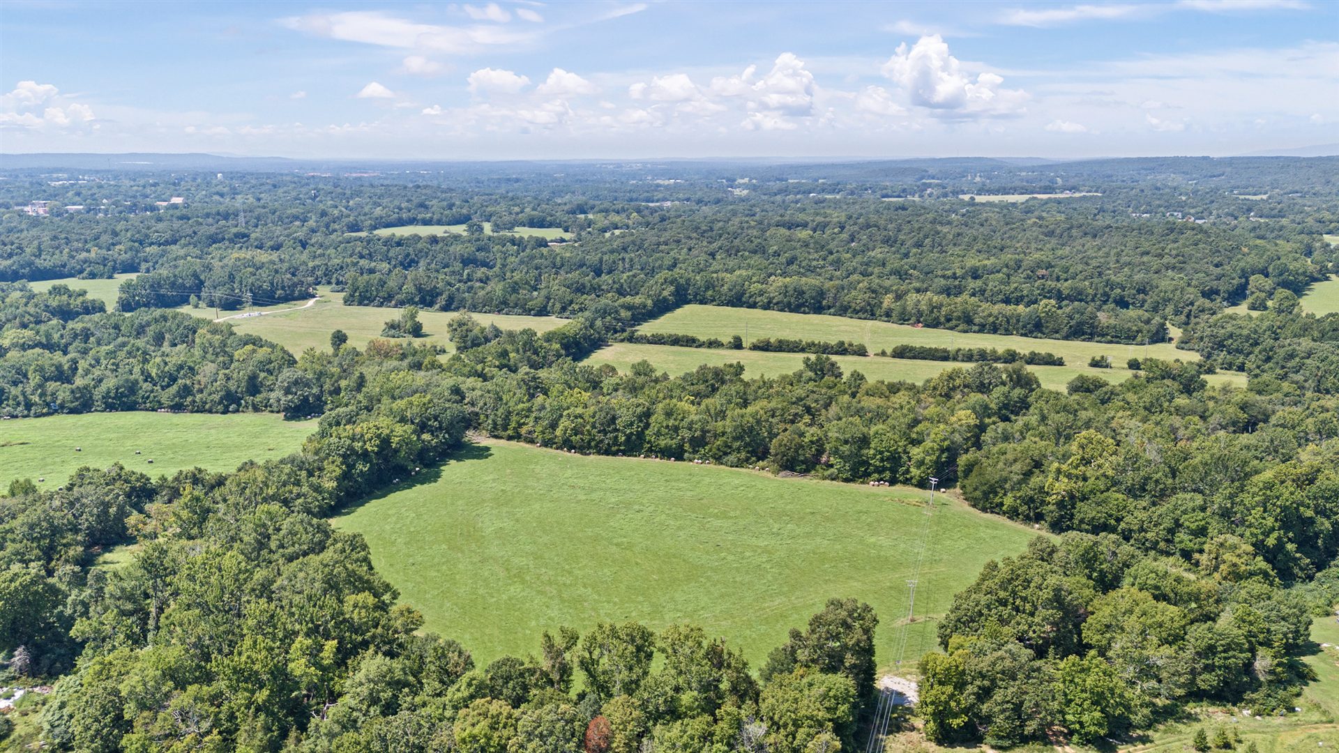
Open pasture gives this acreage room to work as well as room to enjoy. It is suitable for hay, cattle or horses, and the property includes a barn.
Presented by Jacob Moore · Moore and Company REALTORS — Clarksville
You've been saying…
What could 80 acres make possible?
THE LAND COMES FIRST
Open ground gives way to woods. Spadra Creek brings another dimension to the landscape. The appeal is in the combination—and in seeing how it all fits together.
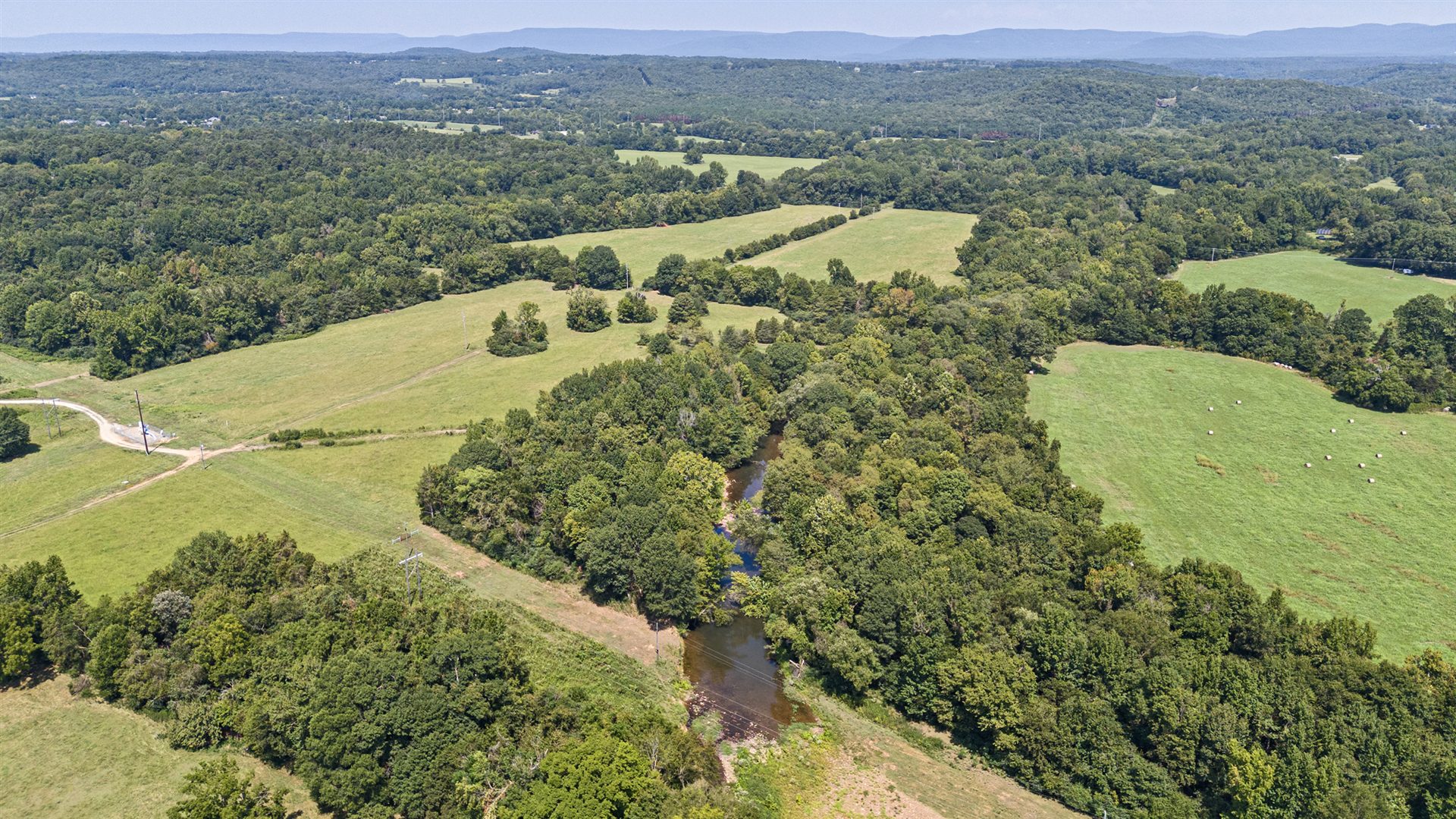
Open pasture gives this acreage room to work as well as room to enjoy. It is suitable for hay, cattle or horses, and the property includes a barn.
The wooded acreage adds privacy, variety and recreational character alongside the open fields. Hunting and fishing opportunities are part of what has drawn buyers to the land.
Spadra Creek brings running water and a wooded creekside setting to the property. Together with the pasture and woods, it gives these approximately 80 acres more than one kind of outdoor space to enjoy.
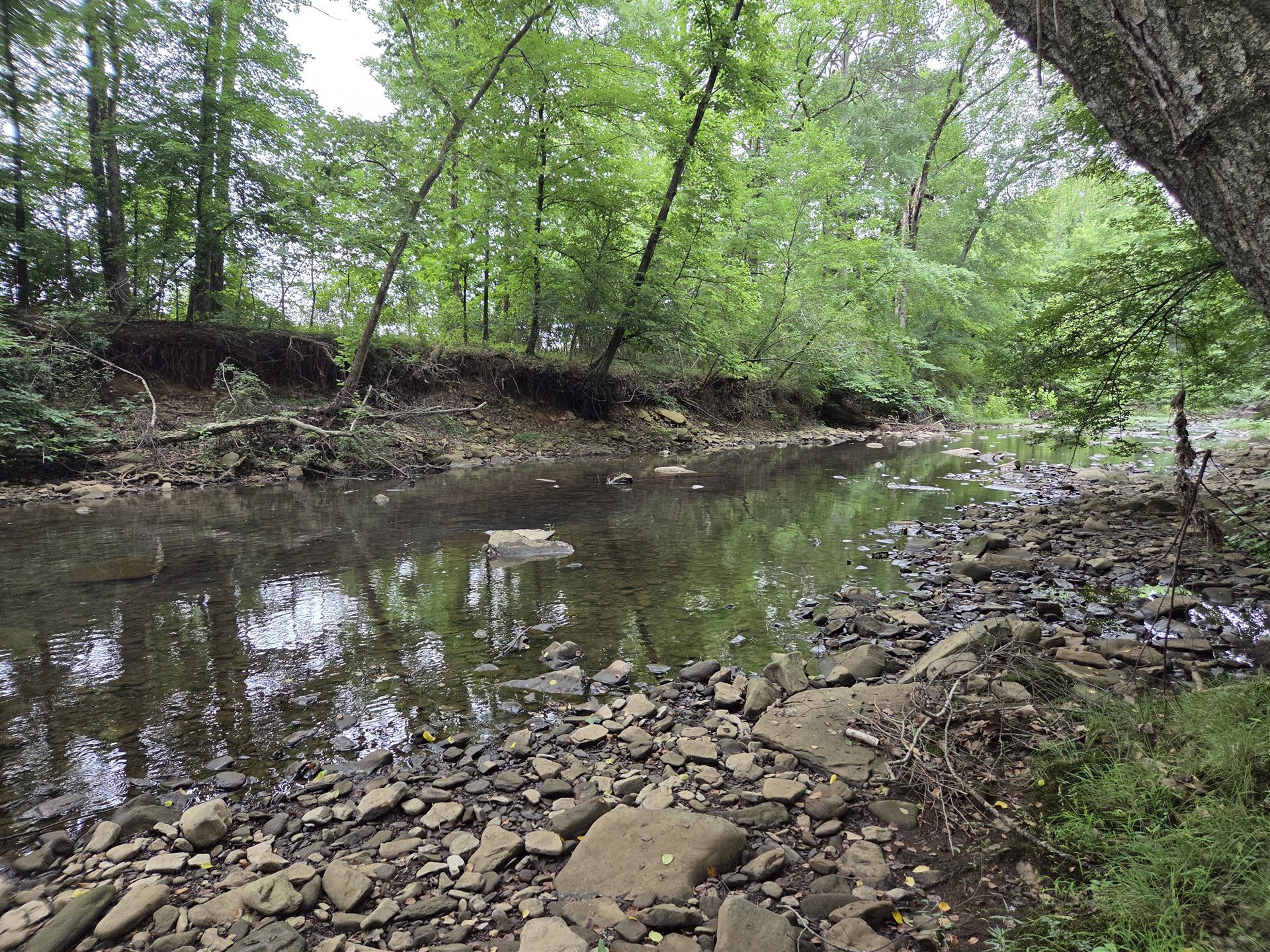
A DIFFERENT VIEW, AT GROUND LEVEL
LOOK A LITTLE CLOSER
The aerial views show the mix of pasture, woods and water. The actual survey adds another layer: two tracts, the existing home and improvements, road access and the mapped floodplain.
Cornerstone Land Surveying · June 14, 2023
Original supplied photograph. No boundaries or flood-zone lines have been redrawn.
Tract 1 is labeled 26.76± acres; Tract 2 is labeled 53.33± acres. Those labels describe survey tracts—not pasture versus woods. The property includes 80± acres.
The home and existing improvements sit near Lee Street and Russell Street, while Spadra Creek runs along the larger tract. These reference points help connect what you see in the aerial photographs with a walk around the property.
Portions of the property are within a FEMA-mapped Special Flood Hazard Area, including one open area that has interested previous buyers as a possible home location. Other areas may not have the same floodplain consideration. The survey’s flood-zone lines are approximate; tract acreage is not floodplain acreage.
Any future building location should be evaluated for the buyer’s specific plans, including surveying, floodplain requirements where applicable, permitting, utilities, insurance and construction feasibility. No particular location is represented here as an approved building site.
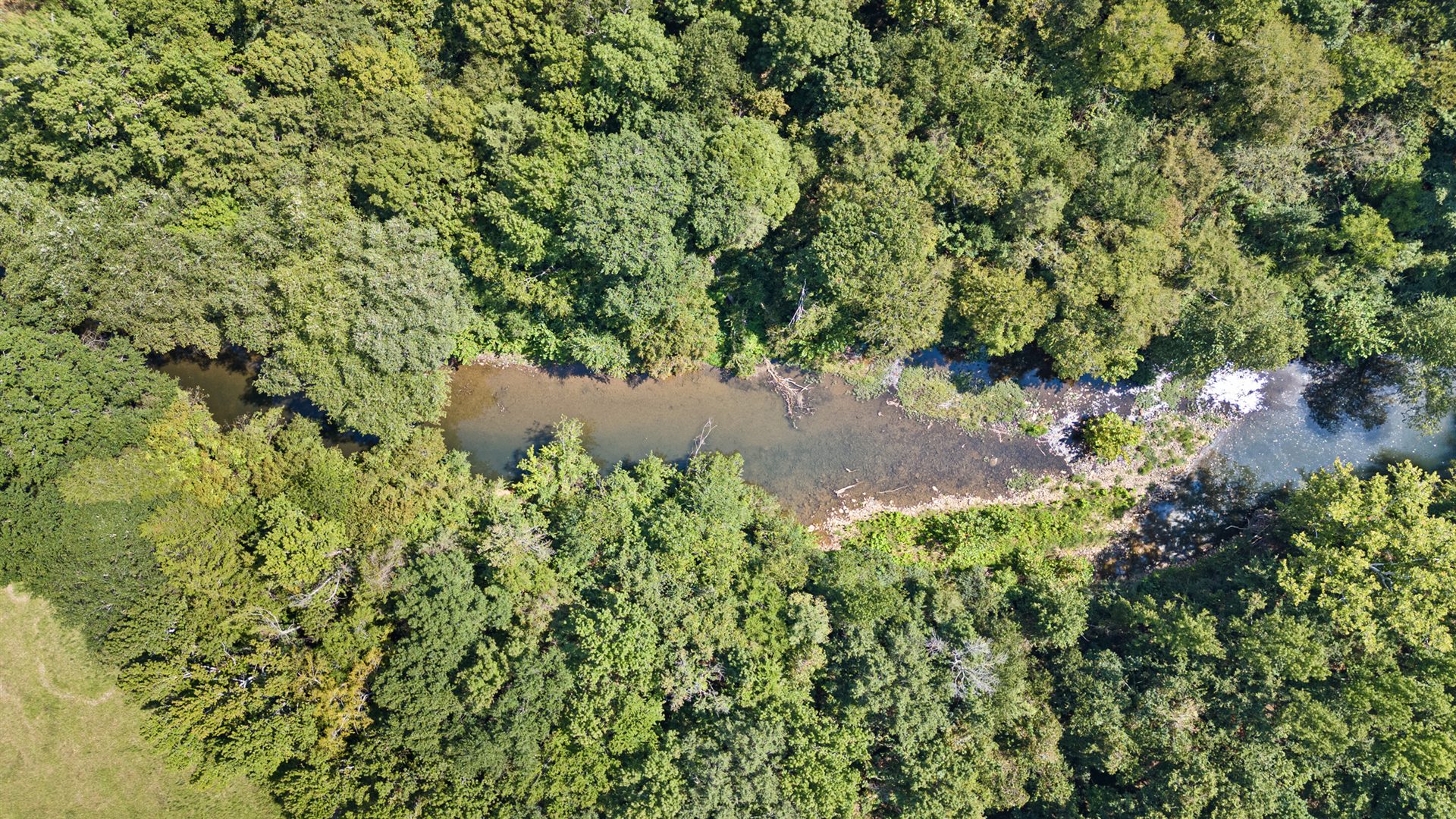
From above, you can see the creek between its wooded banks—a different part of the landscape from the open pasture.
Actual property photography · Aerial view for context; not a boundary or floodplain map.
THE EXISTING FARMHOUSE
The land is the main story. The 1939 farmhouse is part of what’s already here—a tangible starting point as you get to know the property.
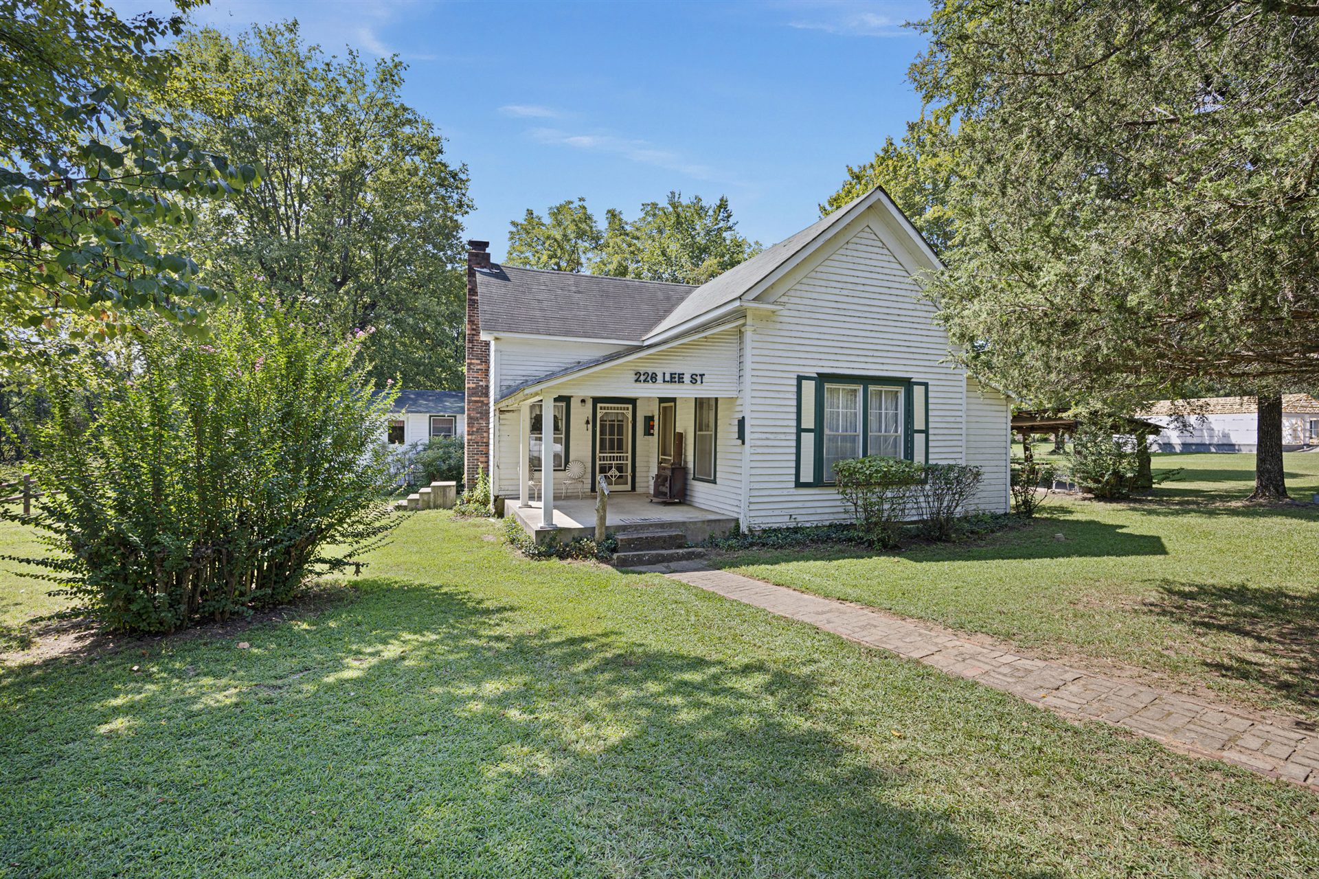
WHAT’S ALREADY HERE
The farmhouse, barn and public utilities are already here, with approximately 80 acres of pasture and woods around them. Town is about two miles away.
A LITTLE ROOM TO THINK BIGGER
Three imagined directions. Choose a concept to see what sparks an idea of your own.
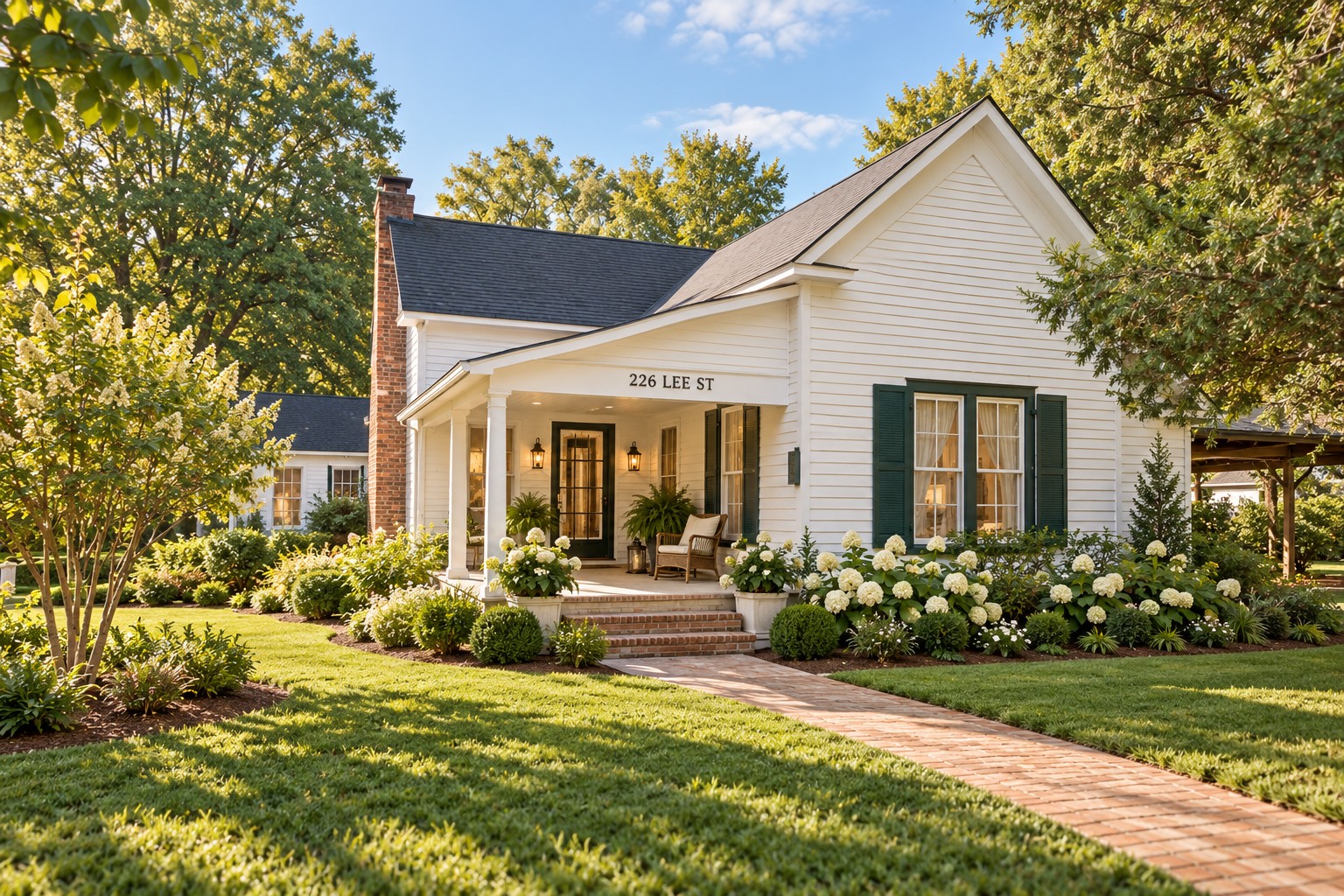
RESTORE WHAT’S HERE
An imagined exterior restoration of the existing 1939 farmhouse, with fresh landscaping and a renewed sense of arrival.
YOUR PHOTO. YOUR IDEA. YOUR OWN AI.
Download the actual property photo below, copy the prompt and open ChatGPT. Attach the photo, paste the prompt and add your own home description there.
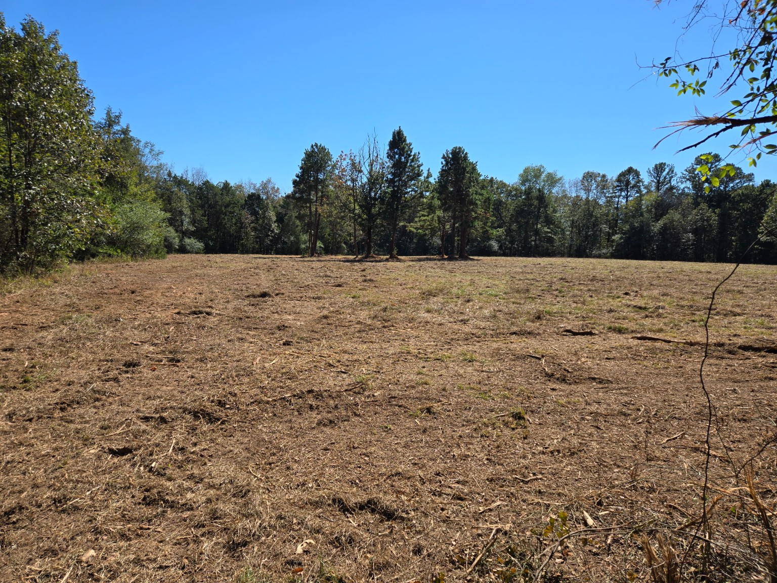
The photo and prompt do not transfer automatically. This Site does not collect or store your dream-home description. ChatGPT’s own terms and privacy settings apply when you use it.
Save the original property photograph. If your device opens it instead, use Save Image.
Add your own description in place of the bracketed text when you paste it into ChatGPT.
Opens in a new tab. Attach the saved photo and paste the prompt to create your own version.
Using this actual photograph of an 80-acre property in Arkansas, create a photorealistic conceptual visualization of the home I describe. Preserve the existing landscape and tree line as much as possible. Do not represent the placement as an approved building site. My dream home is: [describe your home].
AI visualization for inspiration only. Generated images do not represent an approved building site, property boundaries, construction feasibility, flood-zone suitability, permitting, utilities, or improvements included with the property. Buyers should independently evaluate any future building plans.
BEFORE THE NEXT CHAPTER
When you’re considering a property like this, the questions go beyond the listing: where a future home might fit, what the existing farmhouse could offer, and how the land aligns with the life you imagine here. Here are answers from Jacob Moore, who knows this property from time spent on the ground — walking it, showing it, and talking through what different parts of the land could make possible.
Ask Jacob a question ↗With approximately 80 acres, there are different areas you could consider depending on the setting you want. Higher ground could offer the opportunity to clear an area and open up a view, while other parts of the property offer more open land.
One appealing open area is shown within the mapped floodplain, so considering that location would require a closer look at elevation and the requirements for your specific plans. Other areas may not have the same floodplain consideration.
Yes. The existing farmhouse has 3 bedrooms, 1.5 baths and approximately 1,669 square feet, with public water, public sewer and electricity already at the property.
If your long-term plan is to build something new, you could live in the existing house while you decide where you'd like to build and work through your plans. That's a very different starting point from buying completely raw land.
Portions of the property are shown within a mapped floodplain—not the entire 80 acres. The survey included on this page shows the mapped floodplain in relation to the rest of the property.
If you're considering a future home, what matters is where your preferred location sits in relation to that mapped area.
The approximately 80 acres include open pasture, wooded acreage, Spadra Creek, changes in elevation, the existing farmhouse and other improvements.
It's not one large, flat field. Different parts of the property offer open ground, woods, water and higher areas.
There's a good amount of open pasture, so if horses or cattle are part of your plan, there's land here to work with. How you set up the acreage would depend on your animals and plans, including fencing, water and pasture management.
There's also an equipment/tractor barn for storage and maintaining the property.
An existing farmhouse, public water, public sewer, electricity, an equipment/tractor barn and paved/public road access.
If you're comparing Lee Street with raw land for sale in Arkansas, you still get substantial acreage with pasture, woods and a running creek without starting completely from scratch.
Yes. Spadra Creek runs along the property, with wooded acreage surrounding portions of the creek.
If you're looking for land for sale in Arkansas with a creek, Lee Street combines the creek with open pasture, woods, an existing home and public utilities.
226 Lee Street is about two miles from town, with convenient access to Interstate 40 for travel east toward Little Rock or west toward Northwest Arkansas.
There's room for a future home or homestead, horses or cattle, hunting, fishing, recreation, privacy—or some combination of those things.
You have open pasture, woods, a running creek, an equipment barn, an existing home and public utilities, all within about two miles of town.
SOME THINGS YOU HAVE TO SEE FOR YOURSELF
226 Lee Street
Clarksville, Arkansas 72830
$500,000 Asking price
Text Jacob ↗Want to see it in person? Text Jacob.
PRESENTED BY
Moore and Company REALTORS — Clarksville
Direct: (479) 567-0332
Office: (479) 705-3302
jacob.moore@tmoorerealtors.com
View Full Listing Verified link pending